Features.
Speed, depth, shore, map and harbours: everything seegang measures and shows for you on board.
What counts on board.
No gimmicks, just the few values you really look at when you are at the helm.
GPS speedometer in km/h or knots
Easy to read, even on narrow devices. Tap to open the map, the small display comes along.
Distance to shore on the dial
Inner shore zone up to 150 m, outer up to 300 m – measured from your position, not from a point you tapped.
Map depth with the current water level
Lakebed from swisstopo on a 5 m grid, corrected with the latest FOEN water level and your draught.
Wind as it blows on the lake
Gusts and wind direction from MeteoSwiss’s 1 km model. Seven days, hour by hour.
Warning light for strong wind
Like in a car, always in the same place: orange from 46 km/h gusts, flashing red from 61 km/h.
Harbours and landing stages
Guest berths and aerial photo, plus – where known – mooring method and berth size, so you can see whether your boat will fit.
Portrait and landscape
Landscape in the holder at the helm or upright in your hand – the display rearranges itself.
Light, dark, as your device
Follows your phone’s mode. At night with warm instrument light that does not dazzle.
German, French, Italian, English
Fully multilingual – from the lakes on the language border to Ticino.
How deep is it here?
seegang calculates the map depth from the surveyed lakebed and today’s water level. Below it you see how much water is left under your hull.
Estimated – but from measured values: the depth comes from swisstopo’s depth map and today’s water level, not from an echo sounder. Where the lakebed has not been surveyed or the current water level is missing, the app shows no number rather than an invented one.
Map depth
6.4
m
5.6 m under the boat
Estimated · no echo sounder
Distance to shore
412
m
Beyond 300 m
From your position
The whole lake in view.
Upright on the move, landscape for the overview – the whole app turns with you.
On board today: Lakes Biel, Neuchâtel, Murten, Thun, Brienz, Lucerne, Zug, Sarnen, Ägeri, Lauerz, Hallwil, Sempach, Zurich, Walen and Sihl, Lake Geneva, Lake Constance, Lake Maggiore and Lake Lugano – on the border lakes the Swiss shore. Plus four waterways: Zihl Canal, Broye Canal, the Aare to Solothurn and the Zihl in Nidau. Together 305 harbours and landing stages. More to come.


Depth relief
Surveyed lakebed from swisstopo, from light (shallow) to dark (deep). Where there is no survey, it says “not surveyed”.
No-navigation areas
Official closed areas on many lakes, with a warning when you enter one. Signals and buoys remain authoritative.
Shore zones
Dashed lines mark the 150 and 300 m zones where speed limits apply on the lake.
Speedometer always with you
Your speed runs along at the top left, one tap takes you back to the cockpit.
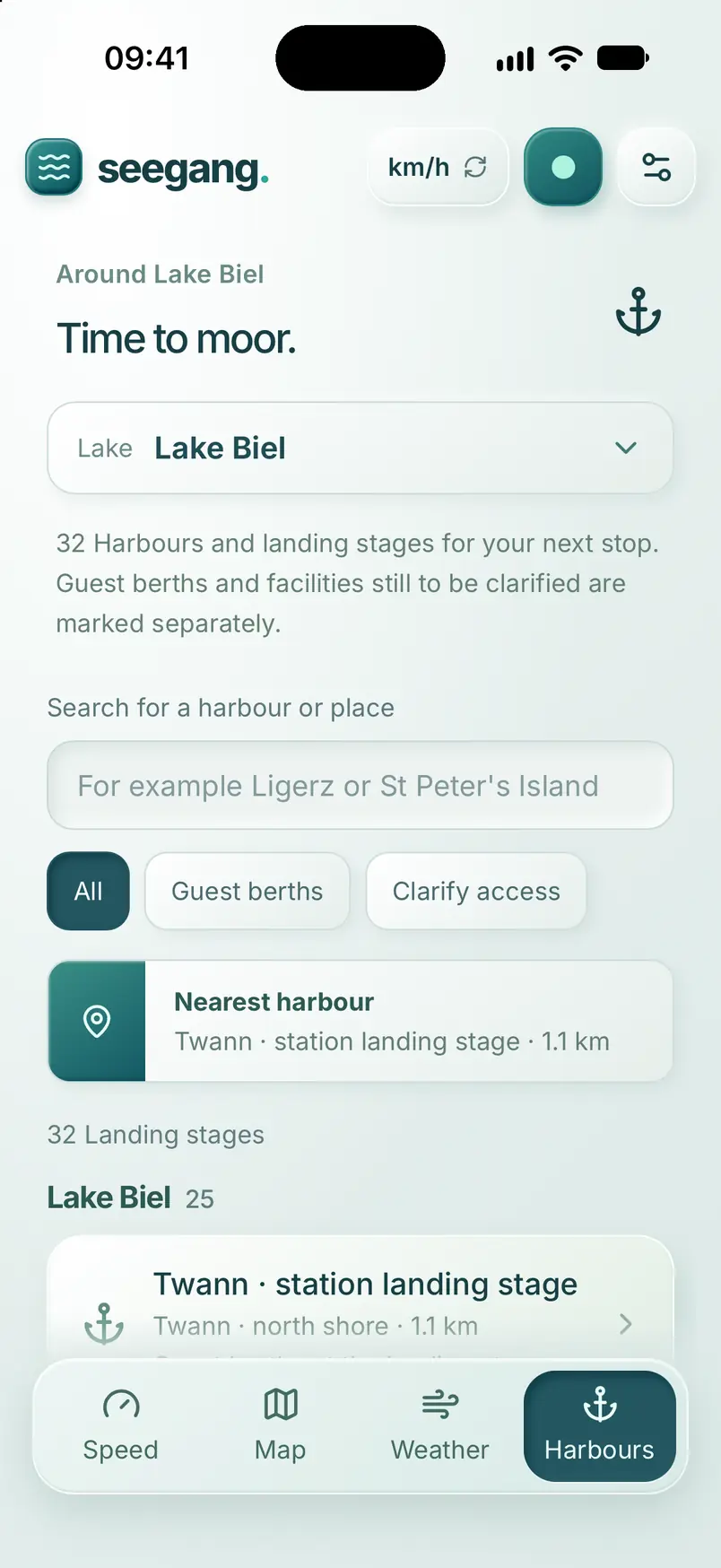
Time to moor.
The harbours and landing stages of your lake – with guest berths, aerial photo and, where known, how to moor.
Guest berths and access
Split into guest berths and facilities whose access you had better check beforehand.
Aerial photo of the entrance
Current swisstopo aerial photo with guest berths, entrance and parking.
Will my boat fit?
Berth width and length compared with your boat’s dimensions – if the harbour states them.



How to moor
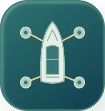
Where the mooring method is known, seegang shows in a diagram how to moor: on a buoy, at a jetty, at a wall or between mooring piles. So you know before entering which lines and fenders you need. If the information is missing, it says “Ask at the harbour”.

Shore ring and post
Pile berth

Mooring piles and jetty berth

Mooring piles and jetty
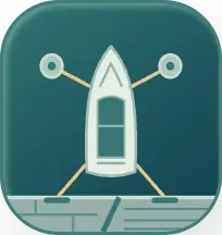
Mixed pile berths

Mooring buoy and jetty
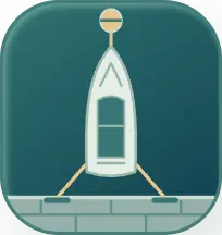
Mooring buoy and wall
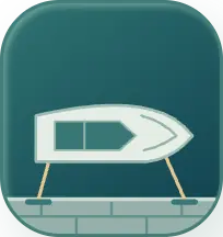
Alongside the wall

Alongside with posts

Mooring line

Bow to the pier

Box at the finger jetty

Bow to the mole, stern to posts

Between two buoys, bow and stern
Weather.
Wind, gusts and rain for your lake – in the forecast and right on the map.


Rain on the map.
Switch on the rain layer and see when a shower is crossing the lake – hour by hour, up to twelve hours ahead.
Four levels
Light, moderate, heavy and very heavy – in the colours of the legend, so you see at a glance what is coming.
Play or pause
The forecast plays by itself. Use the slider to hold a moment.


Demonstration: simulated rain front over Lake Biel.
For every light and every device.
Clear in blazing sun, calm at night – on iPhone, iPhone Duo, iPad and Apple Watch.


Closed: the cockpit.
On the iPhone Duo, seegang already runs on the outside: speed, distance to shore and map depth at a glance.
Open: the map as well.
The speedometer stays on the left, the map is on the right. Split exactly at the fold, so nothing sits in the crease.
On all your devices.
iPhone, iPad, iPhone Duo and Apple Watch – one purchase counts everywhere.


Real data, shown honestly.
Everything seegang shows comes from official and open sources and from the operators – with origin and time. Nothing is embellished, nothing invented.
Lakebed · swisstopo
swissBATHY3D: the surveyed bed of your lake on a 5 m grid.
Water level · FOEN
The current water level at the gauging station. If it is missing, the app shows no depth.
Wind · MeteoSwiss
The 1 km model ICON-CH1, hourly with gusts and direction – including the forecast time.
Aerial photo · swisstopo
SWISSIMAGE for every harbour entrance. No live occupancy, and it says so.
What is missing stays empty.seegang shows no number that is not measured or calculated, and says where it comes from and how old it is. The app does not replace a nautical chart or an echo sounder – the storm warning lights on the shore and the signs on the lake remain binding.
Try seegang before launch.
Before seegang comes to the App Store and Google Play, we’re looking for people who try the app on their lake and tell us honestly what works and what’s missing.
On the water before everyone else
You get seegang before launch, on iPhone, iPad or Android, with every feature. The test costs nothing.
Your opinion counts
Whatever you notice comes straight to us and goes into the app before it reaches the stores.
Invitation by email
We choose the testers and send you the invitation: TestFlight for iPhone and iPad, Google Play for Android.
You can sign up until Sunday, 6 December. The beta test runs until the launch in the App Store and on Google Play. After that, for everyone: 7 days free trial.
At launch: try free for 7 days.
The app is free. When you first open it you choose your lake and get everything for 7 days – without payment details. The trial ends by itself, nothing is charged.


Coming soon
What does seegang cost after that?
Your lake
For each lake you choose: CHF 9 for the season (1 April to 31 October), CHF 15 for the year (until 31 December) or CHF 59 permanently – buy once, no expiry date. Add more lakes when you go out on them.
The three connected lakes
Lakes Biel, Neuchâtel and Murten together, linked by boat via the Zihl and Broye canals: CHF 22 instead of 27 for the season, CHF 37 instead of 45 for the year, CHF 145 instead of 177 permanently.
What stays free
The app itself and the storm and strong wind warning for your lake with the named winds – as a notification on the iPhone, even with the app closed and without a purchase. The Apple Watch app with its warning on your wrist is part of the purchase.
What is included
Speedometer, weather and wind map for your lake, depth relief, distance to shore and shore zones with speed limits and no-navigation areas, harbours with aerial photo and mooring method, Apple Watch with speed limit and wind and storm warning. One purchase counts on iPhone, iPad and Apple Watch.
The lakes
Lakes Biel, Neuchâtel, Murten, Thun, Brienz, Lucerne, Zug, Sarnen, Ägeri, Lauerz, Hallwil, Sempach, Zurich, Walen and Sihl, Lake Geneva, Lake Constance, Lake Maggiore and Lake Lugano – on the border lakes the Swiss shore. Every lake costs the same. For Lakes Lugano, Sihl and Lauerz there is no depth data at the moment.
Good to know
The trial needs no payment details and ends by itself. The season runs from 1 April to 31 October; if you buy from October or in winter, you sail from 1 April. The year is valid until 31 December – bought from 1 October, it is valid immediately and until the end of the following year. Neither renews by itself – the app reminds you a week before the end. A purchase counts on all devices with the same Apple ID or Google account. Prices in Swiss francs.
For businesses around boating
Your business on the lake chart.
Boatyards, service, fuel stations and restaurants with a jetty appear in seegang on the map, with the harbours and under “Problem with the boat?”. Boat rentals and driving schools also get their own boat page behind the QR sticker at the helm.
Learn more
